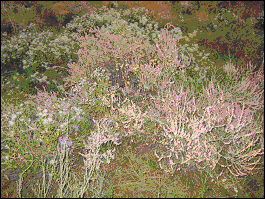
Ak Beshim
Chui
Situated on the eastern edge of Tokmok - near to
the Bus Station, Ak Beshim was once one of the most
important trade and cultural centers in the Chui
valley, inhabited by the Turks and Sogdians. Archaeologists
date the origin of the town to the 5th and 6th Centuries.
It was, in fact, referred to by the Buddhist monk,
Tripitaka (602-644), in his account of his travels.
It later came under Arab influence and faded into
history in the period between the 10th and 12th
centuries. Today all that remains are eroded ridges
and grass covered mounds - although Archaelogists
have conducted several excavations and revealed
much about the thriving city.
There were paved and pebbled streets, water pipes
made from tiles, Buddhist temples a church and a
fortress.
Ala Archa
Chui
The Ala Archa National park was created in 1976
by Government decree and occupies about 120,000
hectares. With snow-covered peaks, steep forested
slopes, picturesque water meadows of the fast-flowing,
noisy Ala-Archa river. The national park is rich
in flora and fauna - with over 800 species of plants
and about 170 species of animals. It has Marco Polo
sheep, wolves, bears, lynx, boar, eagles, and snow
leopards. The hills are lined with Spruce and Juniper
woods.
The base camp is several kilometres from the main
gate and is at 2100m. Trekking to almost 5000m is
possible, although most people stay near the lower
reaches that are often used for picnics.
In the park you can find a small Nature museum and
the Presidential Yurt.
Ak-Sai Canyon - to the left of the gate at base
camp - track leads to Karona Peak (4692m), the Ak-Sai
Glacier - trekking is possible, but equipment is
really needed.
Adygene Gorge - to the right of the gate at the
base camp - walk leads past cemetery for "fallen"
mountaineers, including one who is buried outside
the boundaries because he committed suicide, cutting
himself free to save his comrades rather than pull
them down with him. The path continues for 7m under
the Adygene glacier.
Main Canyon - straight up from the gate at the base
camp - following a jeep track for 18 km to a ski
base with 2 drag lifts.
Alamedin
Chui
The Alamedin valley is one of the most striking
features of the Kyrgyz Krebet, just South of Bishkek.
The village of Koi Tash, 30 km from Bishkek, is
the confluence of four roads: one from the capital;
another which climbs to the West over the ridge,
past Golubini Waterfall (Pigeon's or Dove Waterfall)
to Kashka Suu in the Ala Archa valley; a third to
the East towards Issyk Ata, and the fourth leading
upto the main Alamedin valley. The canyon narrows
and the stream, one of the main rivers flowing through
Bishkek, cascades down to the Chui plain.
Ten kilometers further on is the Tyoplie Klyuchi
Sanatoria. At a height of 1800 meters asl there
is a bathouse with naturally, radon, heated water
and a complex of cottages further up the road, which
was opened in 1984.
Beyond the complex the vista opens out into a beautiful
alpine valley - ideal for a day trip out from the
city. There are waterfalls, glades with berries,
mushrooms, juniper and birch forests and views of
glaciers and the Usechenko peak (4650m), as well
as a number of other canyons to the East.
Burana Tower
Chui
Situated 10 km to the South of Tokmok - the tower
is all that remains of the ancient city of Balasugan
set at the foot of the Shamshy valley. Established
in the 10th century on the site of an older settlement,
the city was the birthplace of the poet Jusup
Balasugyn (1015-?) who wrote an epic poem called
Katadgu Bilim ("The knowledge which brings
happiness"), which has been translated into
several languages - including a recent translation
into English by Walter May.
With Kashgar, Balasugan was one of the capitals
of the Eastern Khanate when the Karakahanid state
split up. It was spared from destruction by Genghis
Khan's Mongols, and renamed Gobalik ("good
city") in the 13th century, but it lost its
importance and had disappeared by the 15th century.
There were major archaeological surveys of the
site in the 1920s, 1950s and 1970s. The archaeologists
discovered that the town had a complicated layout
covering some 25-30 square kilometers. There were
ruins of a central fortress, some handicraft shops,
bazaars, four religious buildings, domestic dwellings,
a bathhouse, a plot of arable land and a water
main (pipes delivering water from a nearby canyon).
Two rings of walls surrounded the town.
The entire museum complex today covers some 36
hectares. It includes the tower itself, reconstructions
of mausoleums found on the site, a mound that
is all that remains of the palace/citadel, a collection
of balbals (grave markers used by nomadic Turkic
peoples who used to roam Central Asia) and petroglyphs
(paintings on stones) and a small Museum. An embankment
on which were built the town walls, made of wattle
and daub, would have surrounded the town.
The tower is believed to be a minaret - and if
so it is the oldest in Central Asia. The name
Burana itself is probably a corruption of the
Turkic word Murana (minaret). A similar, smaller
construction is preserved at Uzgen, near the Uzbek
border, complete with the domed crown and doorways
from which the muezzin would call the faithful
to prayer.
Originally 45 m tall only the bottom 25 m remain
- the top was lost in an earthquake in the 15th
century. The tower has an octagonal base and on
this was constructed a conical tower. On the outside
of the tower is pattern of relief work in brick.
The diameter at the bottom of the tower is 9.3 meters
and the top is 6m across. Inside is a narrow spiral
staircase that is said to be original, leading to
the top. Access would have been by removable stairs,
or through the roof of the mosque - now there is
a metal staircase leading to the door nearly 7 m
above ground on the southern side. From the top
it is possible to get a good view of the Chu valley
and Tokmok. At the foot of the tower are some reconstructions
of the foundations of several ancient mausoleums
made out of burnt brick. These foundations were
uncovered in the 1970s. The different shapes and
sizes indicate the different status and numbers
of occupants.
Nearby is a small hill, measuring 100 metres square
and 10 metres high. It apparently hides a palace
complex (or a temple - the archaeologists aren't
sure), which existed in the 10th century - that
is before the town itself came into being.
A little further away is a collection of "bal-bals"
small statues of the dead - gravestones of the nomadic
Turks) dating from the 6th century, and petroglyphs
dating from the 2nd century BC, brought and placed
here from all around the Chu valley. There are other
collections around the Chu valley and in Southern
Kazakhstan.
The small museum, established in 1976, has some
artifacts recovered from the site (jars, coins,
a board game). In the Shamshy valley itself has
been found a wide range of Scythian artifacts, including
a heavy golden burial mask.
From the Tower, it is possible to head into the
mountains to a picturesque valley to the Kegeti
or Shamshy gorges.
Chon Kemin
Chui
One hundred and fifty kilometers from Bishkek lies
the valley of Chon Kemin. This long valley reaches
over 80 km deep into the mountains between the Kungey
Ala Too and Zailii ranges. It has verdant pastures,
woodland (of Tian Shan firs), mountain lakes (jamalysh,
Kogor, Tor, Almaty and Kichi Kemin amongst them)
and spectacular views of the mountains (for example:
Kichi Kemin - 4220m; Alisher Novoi - 4170m and Teke
Tor - 4190m).
The valley boasts both a Zoological preserve (with
partridges, gold pheasant, hare, wild boar and mountain
sheep) and a botanical reserve (Kapchagai - which
is home to ephedra - horsetail).
Manas is supposed to have held games here and near
the village of Kyzyl Bairak is a mausoleum dedicated
to Shabidan Baitir, a 19th century chieftain of
the Sary Bagysh tribe who ruled the valley and is
highly regarded as a national hero. There is also
a statue of him on horseback in the main square
in the town of Kemin.
There are several ancient barrows (burial mounds)
in the valley at Tegirmenty and Shabdan. Those near
the village of Shabdan, date from the 4th and 3rd
century BC and arcaeologists have discovered the
remains of the ancient settlement of Suyab, dating
between the 6th and 11th centuries AD near the mouth
of the valley.
Chon Tash
Chui
A short distance outside Bishkek is Chon Tash
- now a popular tourist resort for people from
the city. 1991 saw the televised excavation of
a mass grave of some of the victims of Stalinist
repression. Diggers discovered a 4x4x4 chamber,
40 cm below ground, containing some 137 (or 138
according to some sources) skeletons, some complete
with personal effects/papers. It is thought that
the entire Supreme Soviet Central Committee of
the Republic of 1937 - plus a few other important
individuals including Torokul Aitmatov (father
of the Kyrgyz author Chinghiz Aitmatov) were murdered
here by the KGB over two nights. The bodies have
since been moved 100m to the "Ata Beyit"
cemetery ("The cemetery of the fathers").
Holodnaya Voda
Chui
Just before it enters Boom Gorge on the way from
Bishkek to Issyk-Kul, the road passes a collection
of roadside yurts, kiosks and a few newly built
buildings. The local equivalent of a "motorway
café" - the yurts offer a variety
of refreshments - especially the local standard
menu items: shashlyk, manty, laghman and so on;
the kiosks sell chocolates, cola, bottled water
and there are newly built permanent cafes and
toilets ('eastern' style). The name means "Cold
Water" - there is a freshwater spring with
a statue of a deer adorning it.
|
Issyk-Ata
Chui
Seventy seven kilometers from Bishkek, nestled
at a height of 1775 meters a.s.l. in the Issyk-Ata
valley which cuts into the Kyrgyz Range which
runs south of the city. The slopes of the mountains
have numerous alpine meadows and in the vicinity
of the resort are fruit and decorative trees.
The waters have attracted visitors for many centuries
and this used to be a place of pilgrimage and
in the nineteenth century villagers expressed
their gratitude for the healing properties of
the water by smearing onto a large rock which
has an inscription on the Buddha on it which dates
from the tenth century. The Tibetan inscription
is on the face of a boulder with an eagle sculpture
on top. The Soviets built the first permanent
building here as early as 1928. The upper reaches
of the valley are covered in rich vegetation and
are home to herds of horses.
Kaindy
Chui
One of the valleys in the Kyrgyz Krebet. The town
of Kaindy sits across the main road from Bishkek
to Tashkent, and was important for a Sugar factory.
High in the mountains above the town was an early
gold mine. The road climbs gently into the mountains
and though the valley housed a pioneer camp, the
valley is rarely visited by foreigners.
South of Kaindi lies the site of Ashpara - an
ancient settlement dating from the 6th to 12th
centuries. To the south lie some Royal Barrows
- burial mounds dating from the 6th century BC
to the 3rd century BC.
Kant
Chui
The town of Kant lies 30 kilometers to the East
of Bishkek. The word is Kyrgyz for "cube
sugar" and the town owes its name to the
presence of a large sugar factory. The town is
also home to Kyrgyzstan's largest cement factory.
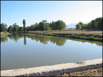
Nearby are Krasnaya Rechka; the Chui river with
some good spots for fishing; and a water reservior
which is favourite spot for swimming amongst the
locals.
To the East of Bishkek, on the road to Kant, lies
the site of Pakap - an ancient settlement dating
from the 6th to 12th centuries.
Kara Balta
Chui
Kara Balta means "Black Axe" in Kyrgyz.
The town, 60 kilometers to the West of Bishkek,
at the junction of two main roads: The main Bishkek-Taraz
(Djambul)-Tashkent road and Kyrgyzstan's main
North-South highway, the Bishkek-Osh road which
climbs through the gorge of the Kara Balta river
to pass over the Tuu Ashu pass into the Suusamyr
plain.
In Soviet times it was a closed city because the
uranium and other metals thatare found in large
deposits in the neighbourhood were mined for military
purposes. Because of this it took on a prosperous
economy with well developed infrastructure, pretty
buildings, tree lined streets and a generally
Russified feel. The closed part of the town is
called Pochtoviy.
Kara Balta is also the name of one of Kyrgyzstan's
bestselling brands of Vodka. Not surprising, because
the town is home to the Bakai factory which produces
many different types of foodstuffs, but most notably
- Vodka.
In the plain leading upto the foothills, south
of the road between Kara Balta and Bishkek are
Barrows (burial mounds), some dating from the
5th to the 2nd century BC. There is also the site
of Karan Zhuvan - an ancient settlement dating
from between the 6th and 12th centuries.
Kashka Suu
Chui
Kashka Suu is a village on the road from Bishkek
to Ala Archa. It is better known amongst locals
for the nearby dachas and the Recreation center
and ski resort located in the foothills above the
village. Even in the summer,when there is no snow,
the locals like to come here for the refreshingly
cool air (to escape the heat of the city) and as
a pleasant place for walking.
Kegeti
Chui
Ninety kilometers East of Bishkek lies the Kegeti
valley with steep forested slopes. The map shows
a road passing over the mountains towards Kochkor
- but it is not really passable - the road is
blocked by landslides and even in the height of
summer it is almost impossible on horseback. There
are Kel-Tor gorge, a side valley and the Kel-Tor
lake (Dead Lake) with it's turquoise water and
numerous beautiful waterfalls. From the valley
you can visit the Bel Saz jailoo, the Sharkeratma
waterfall, Kushkonok forest, Kisil Beles forest,
Chaunde Gorom viewpoint and Kara Unkur (Crying
cave). It is also possible to make a trip into
the neighbouring Tuyuk valley and Karagai Bulak.
The village of Kegeti lies at the mouth of the
gorge although the road into the valley leaves
the main road at Ivanovka and travels through
Ak-Sai, Rotfront and Leskhos.
Kemin
Chui
A regional administrative center which used to
be called Bestrovka - and some older locals still
call it that. There is a statue of Shabidan Baitir,
a 19th century chieftain of the Sary Bagysh tribe
who ruled the region and is highly regarded as
a national hero - and a monument to those who
died in the Civil War.
Kojomkul
Chui
Named after a giant of a man, (he was 2.3 meters
tall), who died in 1955. The village has a small
museum where you can see photographs of him, some
of his clothes and you can see huge stones which
he is reputed to have lifted onto his shoulders.
A little out of town you can another weighing
almost 700kg which he is supposed to have lifted
and placed on the grave of a local official.
The Sports Palace in Bishkek (on Togolok Moldo)
is also named in his honour.
Kok Moinok
Chui
Between the Issyk Ata and Kegeti gorges are tucked
away two small gorges - Tuyuk and Kok Moinok,
connected by the Kok Moinok pass (2911m). Nestled
under the "Sugar Head" peak sits lies
the Kok Moinok lake.
Krasnaya Rechka
Chui
About eight kilometers East of Kant lies the village
of Krasnaya Rechka ("Red River"). This
is the site of the ancient town of Nevkat (NewCity),
a Silk Road city that flourished between the 6th
and 12th centuries. All that remains today are
irregular mounds and a couple of eroded clay walls
of the ancient fortifications, but archaeologists
have found artifacts showing that Buddists, Nestorians
and Manichaenists all thrived here.
"For those who are able to sightsee without
seeing standing buildings," writes Daniel
Prior in The Bishkek Handbook, "Krasnaya
Rechka - prettier in setting and more conducive
to contemplation than the history-factory at Burana
- offers a subtle vista on the past. From the
summit of the citadel, where the ground underfoot
is thickly strewn with pieces of thousand-year-old
pottery, on a clear day, you can see almost to
Ch'ang An and Byzantium."
Kyrgyz Krebet
Chui
The Kyrgyz range of the Tian Shan (or Celestial)
Mountains has several valleys that cut into or
through it. From Kaindi, Tuu Ashu, Ak Suu, Tash
Bulak, Ala Archa, Alamedin, Issyk Ata, Kegeti,
and Shamsy. Each with their own character and
attractions. Many of the valleys have associated
with them.
Kyzyl Oi
Chui
"Red Bowl" in Kyrgyz - the village is
located at 1800 meters asl, 40 kilometers South
of Suusamyr on the main road to Kochkor and Son
Kul. The road travels through the narrow gorge
of the Koko Meren river and into a wide bowl surrounded
by red coloured mountains. The local clay soil
was used to build houses which give the village
a distinctive style and character.
The mountains surrounding the village offer potential
for hiking and horse trekking; the river for rafting.
There are a number of suggested hikes: up the
Char valley and over the Kumbel Pass; to the waterfall
on the Burundi river; to Peak Yr Gailuu (2664m.);
to Peak Chichkhan Choku (3989m.); to Peak Sary
Kamysh (4042m) via the Chockutur pass.
|

