 Oblasts
and cities Oblasts
and cities |
I. Regions:
Administratively Kazakhstan is comprised of 14
oblasts (regions, as of 5.05.97), 84 cities,160
rayons (districts), 10 municipal districts, 195
settlements and 2,150 auls (rural counties).
Cireg
table
South-Kazakhstan (Almaty, Jambyl, South-Kazakhstan
and Kyzylorda regions) is an area rich with ancient
history and culture known for such famous monuments
of medieval architecture as mausoleums of Aisha-Bibi,
Karakhan, Babadzha-Khatun in Taraz, an architectural
ensemble of Khodja Akhmet Yasavi in Turkistan,
etc. This list may be nicely supplemented with
unique Scythian burial mounds in Semirechje (Almaty
region). It is, incidentally, the very region
that has played host to the world-famous space-vehicle
launching site Baikonur. Besides, the region affords
unique climatic opportunities for recreation,
rehabilitation, and hunting, alpinism, mountain
skiing and skating.
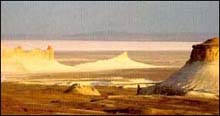
West Kazakhstan (Aktobe, Atyrau, Mangystau
regions) is situated on the crossroads of the
European and Asian continents in the basin of
the Caspian Sea, the Volga and the Ural. It is
the location of the world second deepest depression
- that of Kargije lying 132 m below sea level,
remarkable chalky rocks. One can find here fine
areas rich with game which promise good hunting;
can entertain ideas of good luck in angling, in
water sports. The most important sites are the
Tengiz oilfields, near the eastern shore of the
Caspian Sea, and the Karachaganak gas field, south
of Oral (formerly Uralsk). Aktobe, on the main
rail line to Moscow, about a hundred kilometers
from the Russian border in North-West Kazakhstan,
is a drub industrial city. Atyrau on the Ural
River, 30 km upstream from its mouth on the northern
shore of the Caspian Sea, is "Oil City Kazakhstan",
acting as command station for the main Tengiz
oilfield 350km further south.
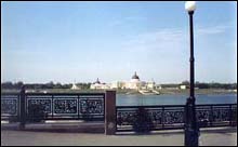
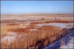
North Kazakhstan Kostanai, North-Kazakhstan
and Pavlodar regions are parts of the northern
Kazakhstan. Everything here - landscape, climatic
conditions - favor all sorts of tourist recreation
- automobile, bicycle, water ones. Health resorts
of Kokshetau, Bayan-aul, Muyaldy offer fine rehabilitation
opportunities while natural preserves Kurgaldzhino
and Naurzum would be quite interesting for amateurs
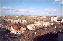
of "cognitive" tourism. Kostanai oblast is located
on the north-west of Kazakhstan. Kostanai came
to existence in 1879 and is an administrative,
trade, industrial, and political centre of oblast.
The city is situated on the coast of Tobol. Oblast
territorial characteristics are: southern outskirts
of the Western-Siberian Plain, down south - part
of the low hills of Sary-Arka. The climate is
continental; winter is cold and long-lasting.
Kostanai oblast is rich in uranium, zirconium,
tin, carbons (technical diamonds), tungsten, molybdenum,
titan, revetment stone, and fire clay.
Central Kazakhstan (Karaganda region) displays
to perfect advantage one of the largest lakes
of the world - the lake of Balkhash supplemented
by a unique mountainous and forest oasis. The
area harbors plenty of memorable places exhibiting
various archaeological and ethnographic relics.
During its lifetime, the new capital of Kazakhstan,
1300 km north - west of Almaty, has gone through
several name changes. Astana is a friendly and
fairly low-rise town with some attractive tree-lined
streets, but prone to strong steppe winds and
very harsh winters.
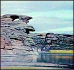
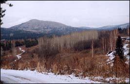
East Kazakhstan is represented by the Altai
and its woods, river of Irtysh and such lakes
as Zaisan, Markakol, Alakol, and Sauskan. Fairly
rich are flora and fauna of the region. Besides
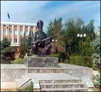
Semipalatinsk region is the birthplace of the
great Kazakh poet - enlightener Abay Kunanbaev,
remarkable writer Mukhtar Auezov. North of Almaty
by 850 km and 700 km east of Astana, Semey is
better known to the world by its Russian name
Semipalatinsk. Markakol Nature Reserve is centred
on Lake Markakol, at 40 km the largest lake to
Altay and 1500 m above sea level, south of Katon
- Karagay. The lake is noted for its pure waters
and beautiful countryside.
II. Cities:
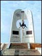
Astana - Capital city of Kazakhstan:
The capital of Kazakhstan was officially shifted
from Almaty to Astana on December 10, 1997 (Akmolinsk
region). The International presentation of Astana,
the new capital of Kazakhstan was held on June
10, 1998. The transfer of the capital from Almaty
to Akmola was prompted by economic, ecological
and geographic expediency. Among the official
reasons cited for abandoning cosmopolitan Almaty,
in Kazakhstan's south-east corner, are the city's
susceptibility to earthquakes and its proximity
to the Chinese border. President Nazarbayev also
says that relocating government institutions to
Akmola will give an economic boost to northern
regions and help spread wealth more evenly around
the country. Besides Almaty is fairly overbuilt,
densely populated and can afford no spare areas
for its further development. No less acute are
transportation problems in the city. Furthermore,
the ecological condition of the "southern capital"
is deteriorating dramatically. Upon a thorough
study of the entire territory of Kazakhstan subject
to 32 parameters including social-and-economic
indices, climate, landscape, seismic condition,
natural environment, engineering and transport
infrastructure, construction facilities, labor
resources, etc., the city of Akmola was chosen
as the best alternative.
The overall condition of Astana, its territory,
the central geographic position in Kazakhstan,
its proximity to major economic regions on the
crossroads of important arterial lines, fairly
stable heat-, water- and power supplies, well-developed
transport infrastructure, balanced natural environment
- all these factors came to be decisive in making
the choice.
Astana was founded in 1824 as a Russian military
outpost and became an administrative center
in 1868. Akmola steppes have always been a territory
of inter-ethnic communication of various nations
and cultures. In the middle of the first millenium
BC the well known Great Silk Route ran through
these steppes. Numerous caravan routes gave birth
to cities with prosperous trade and handicrafts
while the population - apart from traditional
cattle breeding - was engaged in farming. Obviously
these were perspective seats of civilization.
In the XIXth century Akmola was a substantial
commercial and economic center in the Steppe.
On July 16, 1863 Akmola was officially announced
a district city.
The city's importance was greatly enhanced during
the Soviet period by the government's Virgin and
Idle Lands Campaign of the mid-1950s, which aimed
at turning vast Kazakh steppes into wheat fields.
The city was renamed Tselinograd, Russian for
"City of the Virgin Lands". There was considerable
new construction and establishment of various
research and higher educational institutions (teacher
training, agriculture, medicine, and engineering
and construction) in the city. Tselinograd became
the center of an important grain-growing region.
In 1992 the city was returned its former
name - Akmola. Shortly after the official transfer
of the capital, Akmola was given its current
name - Astana (stands for "capital" in Kazakh).
Astana is to become an important cultural and
scientific center of Kazakhstan. It is expected
to create an up-to-date social and spiritual infrastructure,
to open a branch of the National Academy of Sciences,
new educational establishments, a National Library,
a National Museum, a Picture Gallery of Modern
Fine Arts, a Center for social-and-economic technologies,
a Business-Center, a Children's Park, an aqua-park,
various culture-oriented entities and healthcare
establishments.
Population of Astana displays a manifest tendency
for growth particularly due to the expansion of
such vital spheres as transport, communication,
public utilities and services. While the present
population of Astana is 319,000 people, it is
estimated to experience a rise of up to 450,000
people by 2005, and 550,000 - by 2030.
Within the context of realization of contemplated
plans for the development of the economic potential
of the region, starting early 1997 Astana was
given the status of a special economic zone.
Three basic factors determine its expediency:
First, it establishes a free customs zone which
enables all natural and legal entities engaged in
business activities within the confines of the city's
territory enjoy the right of non-taxable import
of goods.
Second, goods manufactured on the territory
of the aforementioned special economic zone, are
subject to exemption from customs duties when exported.
Third, there has been introduced a concessive
taxation regime which first of all applies to enterprises
involved in construction and maintenance of real
estates.
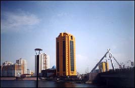
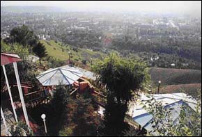
Almaty - Central Asia's most cosmopolitan city:
This blooming city was founded in 1854 as a Russian
frontier fort, when the Kazakhs were still nomads,
on the site of the ancient settlement of Almaty,
which had been destroyed by the Mongols in the
13th century. Almaty has been the capital of Kazakhstan
until late 1997.
The city lies in the northern foothills of the
Trans-Ili Alatau at an elevation of 2,300-3,000
feet (700-900 m), where the Bolshaya and Malaya
Almaatinka rivers emerge into the plain.
Almaty (literally "Father of Apples"), alluding
to the many apple trees in the locality, is not
only the site with ancient history, but also one
of the unique natural places at the earth. Located
at an altitude of 650 meters, where steppe meets
mountain, Almaty is backed, by the snow-capped
Tien Shan to the south and faced by a vast plain
which stretches all the way to Siberia in the
north. Nearby are deep river gorges, babbling
streams, lakes and hills crowned with apple, cherry
and apricot orchards.
Sudden exposure to the outside world turned Almaty
into Central Asia's most cosmopolitan city
with shops, restaurants, hotels and casinos that
would make the place unrecognizable to anyone
who had been away since 1990. Almaty is now a
major industrial center, with the food industry
accounting for about one-third of its industrial
output and light industry for about one-fourth.
There are a great number of institutions of higher
education, research institutes, numerous museums,
libraries, an opera house, theatres producing
in Russian, Kazakh, and Uighur. Almaty also houses
a botanical garden, a zoo, and several stadiums.
Almaty now extends about 12.5 miles (20 km) in
all directions from its center and is considered
one of the most beautiful cities of Kazakhstan
with wide, tree-lined streets, numerous parks,
orchards and a backdrop of picturesque mountains.
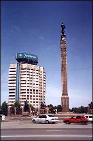
Aktobe:
Formerly Aktubinsk, the city in northwestern Kazakhstan,
on the Ilek River, was founded in 1869 as Aktyube
("White Hill"), a small Russian fort.
The first Russian peasant settlers arrived in
1878. In 1891 it became the capital of an uyezd
(canton) and in 1932 of an oblast (region). During
World War II a ferroalloys plant was built to
smelt the nickel and chromium ores of the Mughalzhar
(Mugodzhar) Hills. Now an important industrial
center, Aktobe produces chromium compounds, X-ray
apparatus, and parts for agricultural machinery
and has stockyards and flour mills. Cultural assets
include a teacher-training and a medical institute,
a theatre, several museums, and a planetarium.
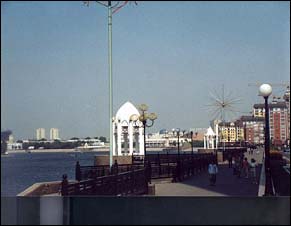
Atyrau:
The city in western Kazakstan formerly named Guryev
(until 1992) - a crossroad between Asia and Europe
- was founded as a fishing settlement in the mid-17th
century by the fishing entrepreneur Mikhail Guryev.
 |
It soon became a fort
on the Ural fortified line manned by the Ural Cossacks.
Fishing and trade were the main economic activities
until Soviet times. Now, in addition to a large
fish cannery, there are strong oil refineries (houses
one of the biggest oil reserve fields in the world-Tengiz),
petrochemical plant, metalworking and construction-materials
industries, a meat-packing plant, and ship-repair
yards. A branch of the Kazakstan Academy of Sciences
studies the natural resources of the area, and the
city has a teacher-training institute, a museum,
and a theatre.
Aktau:
Aktau was founded in the 1960´s as a uranium-mining
town. It sits on the eastern shore of the Caspian
Sea and the surrounding area consists of desert.
All of the town's water is derived from desalination
plants. AKtau was planned by Soviet architects and
is laid out in a straightforward grid of wide streets,
lined with universal apartment blocks to house the
workers of the nearby uranium mines. The lake shore
had perfect sandy beaches and AKtau developed into
a holiday resort for the Soviet elite. After the
collapse of the Soviet Union, demands for uranium
declined and so did the number of tourists. Aktau
survived the crises period in the country with honor
and began to develop further after Kazakhstan got
its independence. The last 10 years were marked
by significant economic growth in the region.
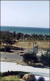
Aktau has a lot of potential in tourism and will soon open a new economical zone aimed at attracting investors.
Karaganda
The city, in central Kazakstan, lies at the center of the important Karaganda coal basin. It is the second largest city in the republic and derives its name from the caragana bush, which grows abundantly in the surrounding steppe.
The first settlement appeared in 1856, and small-scale coal mining began in 1857 to supply a nearby copper smelter. Coal mining and the production of coal-mining machinery still dominate Karaganda's industry, but there are also major iron and steel works, utilizing ore from Karazhal and Lisakovsk; in addition, there are large cement plants and also food and other light industries.
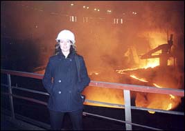
The city consists of several dozen settlements scattered over an area of approximately 300 square miles (800 square km), but there are two main areas, the Old and New towns. The Old Town grew up in a haphazard fashion in the early years and includes more than 20 pit settlements, whereas the New Town was designed as the cultural and administrative centre, has wide streets, parks, and numerous monumental buildings. There are a few mosques and churches to see. Tours are available to Temirtau, 20 mi/30 km away, where there is a sports complex, a locally acclaimed children's park and the only German-language theater in Central Asia.
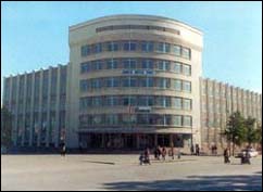
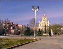
Kostanay
The city in northern Kazakstan, on the Tobyl River, was founded by Russian settlers from the Volga region in 1879, it became a centre of trade in the steppe, a role that was enhanced by the construction of a branch railway in 1913. Kostanay was made an oblast (region) administrative center in 1933, but its greatest expansion dates from the mid-1950s and the Virgin and Idle Lands Campaign, which extended agriculture, hastened the exploitation of mineral wealth, and the construction of rail lines in the region. The city's most economically important industries are food processing and other light enterprises, though there are vehicle and agricultural-equipment repair shops, and spare parts are produced for excavators and mining equipment.
Pavlodar:
The city in northeastern Kazakhstan.
It is a port on the Irtysh River. The community
was founded in 1720 as Koryakovsky outpost on the
Russian Irtysh fortified line, near salt lakes.
It became the town of Pavlodar in 1861, but, although
it did a substantial trade in salt and agricultural
produce, its population was only about 8,000 in
1897. Since then and particularly since the mid-1960s,
it has grown considerably to become a major industrial
center, with tractor, aluminium, and chemical plants.
An oil refinery was completed in 1978. The city
has industrial and teacher-training institutes.
Petropavlovsk:
The city in northern Kazakstan. It
lies along the Esil (Ishim) River in the centre
of the Esil Steppe. Petropavlovsk was founded as
a Russian fort in 1752 and soon became an important
centre of trade between Russia and Central Asia
and the Kazakh steppes. The Trans-Siberian Railroad
reached Petropavlovsk in 1896, and by 1917 the population
was nearly 50,000. Petropavlovsk now has some notable
industrial undertakings and is also important as
the junction of the Trans-Siberian and Trans-Kazakhstan
railroads. The city has a theatre, a television
station, and a teacher-training institute
Urask:
The city in western Kazakstan, along the Ural River.
Founded in 1613 or 1622 by Cossacks fleeing a tsarist
punitive campaign, it was known as Yaitsky Gorodok
until 1775, when its name was changed following
the Pugachov Rebellion. The town was a centre of
both the Stepka Razin (1667) and Yemelyan Pugachov
(1773) uprisings and was the headquarters of the
Ural Cossacks. It had a lively trade with European
Russia in fish from the Ural River and livestock
products from the Kazak steppes. Its commercial
importance began to decline in the early 20th century
when the new railway to Turkistan bypassed it. Oral's
industries today include leather and footwear, meat-packing,
flour milling, some engineering, and a licorice
works. The city houses the oldest theatre in Kazakstan,
and a museum with historic Cossack mementos.The
economy of the surrounding area is almost entirely
agricultural, with stock breeding (sheep, goats,
cattle, horses, and camels) predominating. Wheat,
barley, and other grains are grown, and there are
also extensive haylands.
Kzylorda:
The city in south-central Kazakstan, on the Syr Darya river. Originally founded in the early 19th century as the Kokand fort of Ak-Mechet, it was renamed Perovsk after its capture by the Russians in 1853. After the Russian Revolution of 1917 the name of Ak-Mechet was restored, but in 1925 the city was renamed Kzyl-Orda, when it became the capital of the Kazakh A.S.S.R., a status that it lost to Almaty in 1929. There are some food and other light industries, as well as a Kazakh theatre and a teacher-training institute.
Taraz:
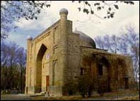
The city in southern Kazakstan, Taraz lies at the junction of the Talas River and the Turk-Sib Railway. It is one of the oldest towns of Kazakstan. It stands on the site of the ancient city of Taraz, which flourished as a stop along the Silk Road until it was destroyed by Mongol armies in the 13th century. A new town called Auliye-Ata was established on the site by the emirs of Kokand in the late 18th century. The fort and town were captured by the Russians in 1864, and between 1938 and 1992 the town was renamed Dzhambyl for the Kazak poet Jambyl Jabayev (1846-1945). Primarily an industrial city, Dzhambul (lately renamed Taraz again) does have some interesting sites. The Kara Khan Mausoleum, the Shamansur Mausoleum, are both nearly 1,000 years old and have interesting terra-cotta exteriors, carved to make the buildings look as if they were woven from straw. The Aisha-Bibi and Babadja-Hatun Mausoleums are beutiful masterpieces of the ancient Asian history.
Ust-Kamenogorsk:
Ust-Kamenogorsk is the center of the Eastern Kazakhstan region. It was founded in August of 1720 by leib-guardian mayor Ivan Liharev who was sent by Peter the First in search of gold in the environs of a Jungarian city called Erketi (present day Yarkent, a city in the Chinese province Sin-Tsyan). At the confluence of two rivers, the Irtysh and the Ulba, Liharev constructed the fortress Ust-Kamenogorsk which later became one of the most important positions in the frontier system of the Russian Empire.In the 18th -19th centuries the city was mainly a trading center. Caravan routes to Mongolia and China started from here. Study and reclamation expeditions to Rudny Altai, Kazakhstan, Middle Asia and China went through Ust-Kamenogorsk. With the development of mining and metallurgical industries, particularly after the Ridder and Zyryanovsk deposits had been discovered, the city played a role of a transit base, from which the ores were sent to the metallurgical plants of Barnaul and Central Russia. At the end of the 19th and beginning of the 20th centuries Ust-Kamenogorsk was the center of gold mining industry in the Kazakhstan part of Altai. Today Ust-Kamenogorsk is one of the largest power supplying, industrial, and transport cities of the republic.
Shymkent:
The city in south-central Kazakstan. It lies in the valley of the Sayram River in the foothills of the Ugam Range at an elevation of 1,680 feet (512 m). Originally a settlement on the caravan route from Central Asia to China, Shymkent dates back at least to the 12th century and was more than once destroyed by nomad attacks. After becoming part of the khanate of Kokand in the early 19th century, it was captured by the Russians in 1864. A pharmaceutical (santonin) works was constructed there in 1885. Shymkent's population increased twelvefold from 1926 to 1970. It is now the third largest city in Kazakstan and a major industrial and cultural center, as well as an important railway junction. The city has large lead, automatic-press, and cement works, with a chemical industry (processing phosphates from Karatau) and food and light industries. Shymkent also has teacher-training, technological, and cultural institutes, cement and Karakul-breeding research institutes, Kazakh and Russian theatres. Shymkent is notable chiefly as the home of Astrakhan coats-the Karakul Sheep Breeding Museum has an exhibit demonstrating how the sheepskins are processed to give pelts that tight, curly, twisted look.
|

